Geospatial Services (GIS)
Home » Departments » Geospatial Services

Geospatial Services is a division of the City’s Information Technology Department. The Geospatial Services Division provides the means by which City departments can create, store, display, and analyze data (parcels, zoning, streets, utilities, etc.) for critical decision-making. GIS is the primary tool for leveraging this data, and it is available to the public through our GeoHub and to City employees through ArcGIS Online.
- The City’s GIS data can be downloaded from the City of Round Rock’s GeoHub.
- If you can’t find what you’re looking for in our GeoHub, feel free to contact us via the contact information at the bottom of this page.
- See the video at the bottom of this page for a tour and basic use instructions for the GeoHub.
- Information regarding open records requests can be found here.
Reference Monuments and data sheets for surveyors and engineers can be found in the links below.
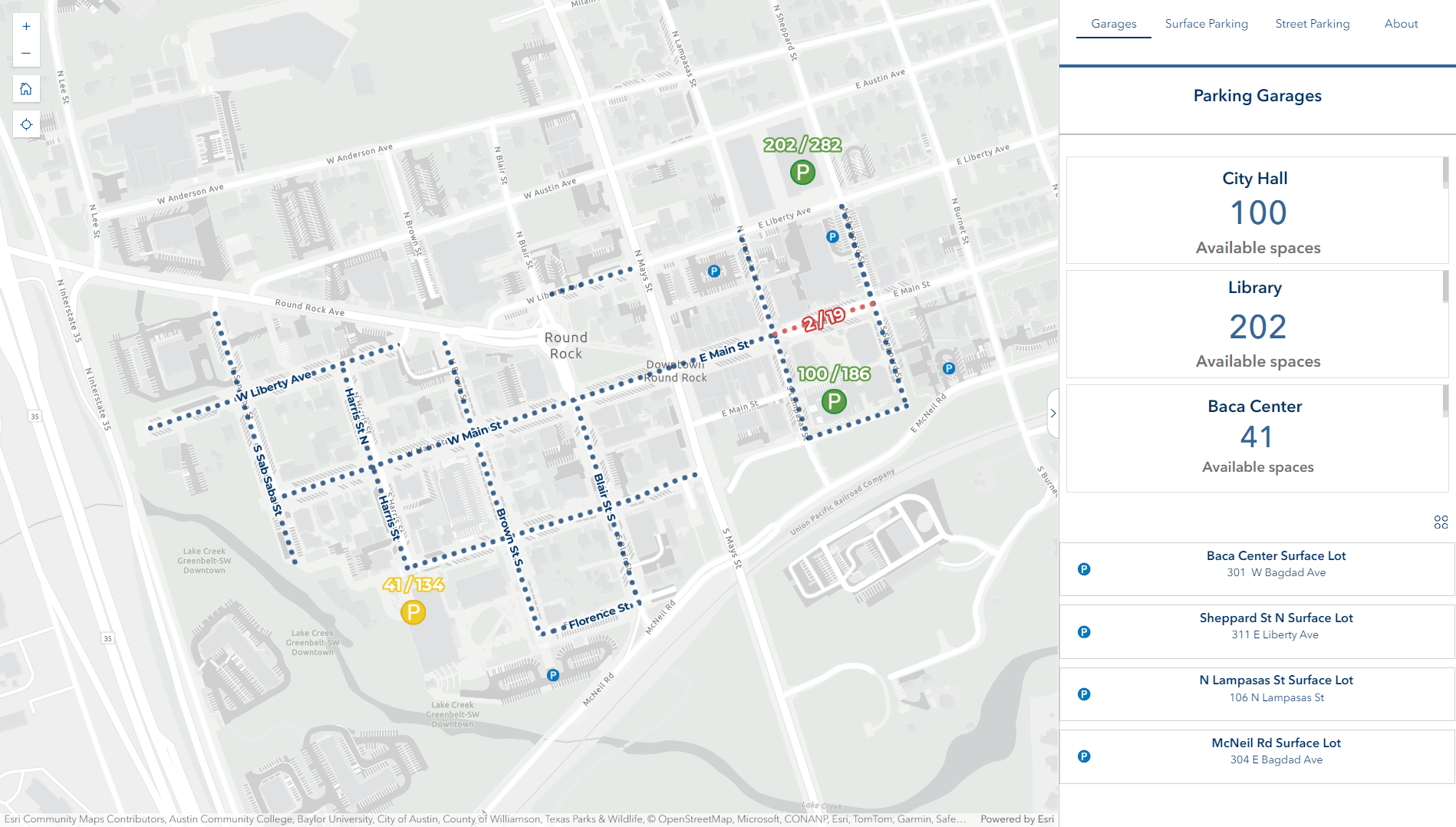
Local GIS
- City of Georgetown Maps & GIS
- City of Cedar Park Maps & GIS
- City of Leander GIS
- City of Pflugerville GIS Services
- City of Austin GIS & Maps
Regional GIS
- Williamson County GIS & Addressing
- Williamson County GIS Council
- Williamson County Appraisal District (WCAD)
- Capital Area Council of Governments (CAPCOG) Data, Maps, and Reports
Statewide GIS
Can’t find what you’re looking for? Questions can be directed to:
Nathan Smith
Geospatial Services Manager
nsmith@roundrocktexas.gov
DISCLAIMER:
Though care has been taken to produce these datasets and interactive map viewers, the City of Round Rock makes no claim as to the accuracy or completeness of these maps or the data contained within. Parcel data is for informational purposes and does not constitute a legal land boundary survey. Locations of underground utilities may be approximate and not always intended for official use or construction.