Additional relief from flooding is in sight for more than 1,000 Round Rock homes as construction nears completion on a major dam project along Lake Creek.
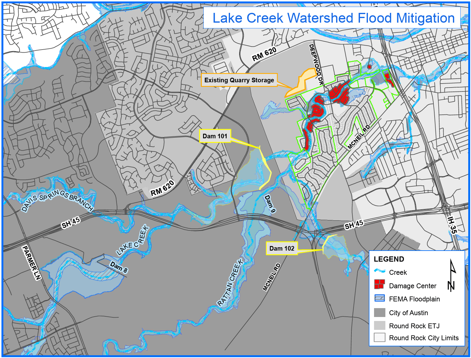
Dam 101 is being constructed just outside Round Rock’s city limits, east of O’Connor Drive, north of State Highway 45 and south of RM 620. The site sits along Lake Creek in an area historically prone to flooding, particularly affecting neighborhoods like Greater Round Rock West, which experienced flooding from Lake Creek in 2010 and again during Memorial Day weekend in 2015.
Nearly a mile long and four stories tall, the dam will reduce the flood risk for more than five miles of Lake Creek by containing runoff during heavy rain events.
Dam 101 is the result of a long-term, collaborative effort to address flood risks in the Lake Creek watershed. After Tropical Storm Hermine caused widespread flooding in 2010, the Upper Brushy Creek Water Control and Improvement District (WCID) launched a watershed study that led to a regional Flood Protection Plan and a comprehensive Dam Assessment Study identifying Dam 101 as a priority project. These planning efforts culminated in November 2020, when Upper Brushy Creek WCID voters approved an $85 million bond program to fund flood safety projects throughout the watershed. This bond program funded the Lake Creek Flood Mitigation Projects—including Dam 101, modifications to a quarry along RM 620, and construction of a smaller dam, Dam 102, less than a mile south of Dam 101. While the WCID has served as the lead agency on the Dam 101 project, the City of Round Rock supported the project through design and funding. Williamson County, the Texas Water Development Board and local stakeholders also provided valuable input during the planning stages.
Completion of the construction is expected late this year. Upon completion of Dam 101, coordinators will notify the Federal Emergency Management Agency (FEMA), which will then determine if changes to the floodplain in the affected area would allow homeowner insurance rates to be adjusted accordingly.
The Upper Brushy Creek WCID was created in 1956 and has developed to include more than 40,000 homes between Leander and Hutto. For more information on the WCID’s projects and status updates, visit www.ubcdams.org.
Members of the Round Rock City Council and City staff recently visited the project site to see the construction in action. Check out the progress on the project below: