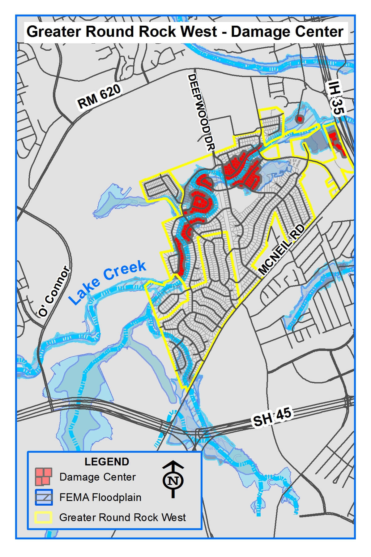
Currently more than 80 homes and all roadways crossing Lake Creek within the Greater Round Rock West neighborhood, are located within the 100-year floodplain which means they have a 1% annual chance of flooding. In addition, many of these homes and roadways are more vulnerable as they are located within the 10-year floodplain (10% annual chance of flooding). The Greater Round Rock West Neighborhood was identified as the largest damage center within the Upper Brushy Creek Water Control Improvement District (District) watershed study. A damage center represents an area that has multiple homes and roadways at risk of flooding.
Challenges
- The scale of flooding makes regulatory dams the only feasible solution.
- The current estimated costs for the projects is over $30 million dollars.
- The floodwaters originate in the City of Austin and Williamson County.
- The dams must be constructed in an area that is within the Edwards Aquifer Recharge Zone and habitat for several endangered species.
The project complexities have prevented any single agency from resolving the flooding issue for over 30 years. Leveraging the cooperation, resources, and aptitudes of multiple jurisdictions provides a pathway that can finally bring flood relief to this vulnerable area.
Proposed Solution
The City, in collaboration with the District, has formulated a plan to alleviate flooding along Lake Creek. The plan involves constructing two dams, known as Dams 101 and 102 (map), upstream from the at-risk homes and roadways. Both dams are needed to provide the desired flood mitigation to the areas downstream. The City and the District are working together to advance the projects. The City will lead design and construction for Dam 101 and the District will lead design and construction of Dam 102. Both the City and the District have committed funds to the projects however additional funding is still needed before construction can begin. When completed, the District will operate and maintain the dams.
Project Benefits
+ Removes more than 80 homes from the 1% floodplain while preserving neighborhood value.
+ Significantly improves emergency access by reducing the flooding of creek crossings along Lake Creek.
+ Reduces flooding depth for additional homes and roadways located downstream.
History and Background
The Lake Creek Watershed covers approximately 28 square miles beginning in Austin and extending east through Williamson County and into Round Rock where it drains into Brushy Creek. In the late 1970s and early 1980s flood risk maps did not exist for the area. As a result, many homes in the Greater Round Rock West neighborhood were built in the area which was later designated floodplain. These homes suffered multiple severe floods during the 1980s which drove the efforts to get FEMA to establish floodplain maps in the area.
Since being built, upstream development has greatly increased the depth of floodwaters putting additional homes at risk. A temporary diversion of floodwaters into nearby quarries protected the homes from flooding for many years. The temporary solution is no longer viable, which contributed to the flooding in 2010. Frequent flooding has continued in the neighborhood with the most recent property damage resulting from the flooding from Tropical Storm Hermine in 2010.
The dams would be earthen structures with concrete spillways similar to the existing 23 dams that the District already maintains. During a heavy rainfall event, the dams slow the rush of water from entering the neighborhood by holding the water back in planned flood-pools and releasing it slowly. The dams function passively without floodgates or requiring other mechanical adjustments. The newly planned dams are expected to pass through the smaller storm events to ensure natural stream flows are preserved.