The city’s long-range planning activities help to shape its development and land use policies as it grows and evolves. These policies are implemented by amending the Code of Ordinances, adjusting development standards, and refining development processes.
Downtown Zoning
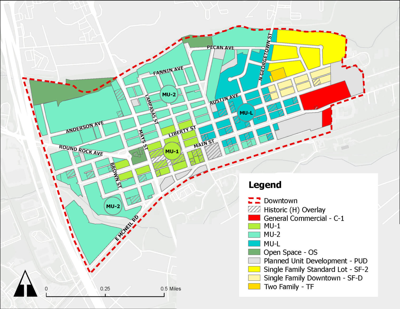
In 2025 PDS staff undertook an extensive reevaluation of the downtown mixed-use zoning districts to ensure they meet the needs and preferences of the Round Rock community today. On October 23, 2025 the City Council adopted extensive zoning ordinance amendments and rezoned 114 downtown properties.
The Downtown Planning page describes these amendments and resulting standards changes for sign, MFE (food truck), and sidewalk furniture permits. A Downtown Mixed-Use Zoning User Guide was created to assist property owners, businesses, developers, and residents with their downtown projects. For information about how the zoning amendments were developed, refer to the Downtown Zoning page.
Round Rock 2030 Comprehensive Plan
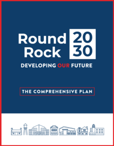
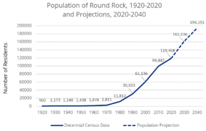
(Adopted June 25, 2020) Round Rock 2030 is the official policy document guiding long-range planning and community development in the City of Round Rock. The Comprehensive Plan is updated every ten years; refer to the Round Rock 2030 project page. Since that time, Round Rock has continued its rapid population growth and development, as well as its transition from a suburb of Austin to a vibrant and prosperous mid-sized city. With Round Rock’s dramatic growth has come a new series of challenges to ensure continued success. Round Rock 2030 highlights how Round Rock has changed and establishes a vision for the next decade.
- Round Rock 2030 website
- Round Rock 2030: Developing Our Future (pdf)
- Future Land Use Map (pdf)
- Round Rock 2030 wins Comprehensive Planning Award from the American Planning Association (APA) Texas Chapter
- Round Rock 2030 Annual Report for 2023-2024 (pdf)
- Round Rock 2030 Annual Report for 2022-2023 (pdf)
- Round Rock 2030 Annual Report for 2021-2022 (pdf)
- Round Rock 2030 Annual Report for 2020-2021 (pdf)
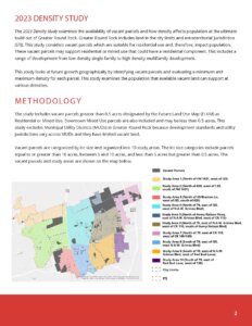
- 2023 Density Study (pdf) 11/16/23
- Senior Housing: Options and Availability in Greater Round Rock (pdf) 8/14/23
- Residential Options in Downtown Mixed-Use Districts (pdf) 2022
- 2020-2040 Population Projections Report (pdf) 8/23/22
- 2020 Census Release Report (pdf) 10/1/21
- Refer to the Demographics page for more information.
Round Rock Development Code
(Adopted September 27, 2018) The Round Rock Development Code (RDC) is a separate section of the Code of Ordinances that addresses all aspect of land development, including subdivision platting, zoning, site plan review, landscaping and tree protection, signs, and technical building codes. This improves clarity, consistency of regulations and interpretation, and creates an opportunity to update regulations and reshape certain policies.
Multifamily Zoning Districts
One of the goals of the 2010 General Plan is to encourage a wider variety of housing types available in Round Rock, with sensitivity to the character of surrounding development. Under the 2002 zoning ordinance there was one multifamily zoning district (MF), which did not distinguish between low- and medium-density multifamily development, and did not allow higher-density multifamily at all. The original multifamily zoning district (MF) was replaced with three new districts of different densities. The standards for the MF-2 district are very similar to the earlier MF district, and MF properties were rezoned to the MF-2 district.
- MF-1 (Low-density Multifamily) (such as townhomes and 4-plexes,)
- MF-2 (Medium-density Multifamily) (such as 2- or 3-story walkup complexes)
- MF-3 (High-density Multifamily) (tall apartment buildings)
Sign Ordinance
(adopted March 2013) Round Rock recently overhauled its sign ordinance to better balance business needs for advertising and wayfinding with community goals for traffic safety and an attractive streetscape. The new ordinance includes sets of development standards appropriate for different road types in order to create a more consistent streetscape, while remaining be flexible enough to avoid a monotonous appearance and to accommodate changes in sign manufacturing technologies. The ordinance was developed with input from homeowners and neighborhood associations, sign companies, local businesses, the Texas Sign Association, the Planning & Zoning Commission, and the City Council.
Neighborhood and Area Plans
The city has made it a priority to maintain the quality of life for its residents. Like a general plan, area plans establish a vision and guide decision making for specific areas of the city that are undergoing significant change, such as a change in allowable land uses. Neighborhood plans are undertaken to establish a vision and strategy for improving the quality of life in existing residential neighborhoods. Many of the issues that were addressed through neighborhood plans are now a function of Community and Neighborhood Services.
- Southwest Downtown Plan (2005), replaced by the Downtown Master Plan (2010) and Downtown Mixed-Use Zoning Districts (2013)
- Chisholm Valley Neighborhood Improvement Plan (2001)
- Greater Lake Creek Neighborhood Improvement Plan (2001)
- Palm Valley Area Planning & Design Study (2000)
- Northeast Neighborhood Plan (1998)
- Greater Round Rock West Plan (1996)
- Downtown Neighborhood Plan (1994, reviewed in 2002)